Crete Maps & City Maps
Maps of Crete
In this page you will find various maps of Crete. You will also find detailed maps of the main towns and cities in Crete: Heraklion, Chania, Rethymnon, Agios Nikolaos and Sitia.
Table of Contents
Map of the 4 administrative regions of Crete
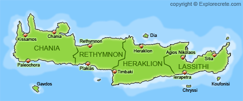
Crete is divided into 4 administrative regions:
- The region of Chania or Hania in Western Crete
- The region of Rethymno in Western Crete
- The region of Heraklion in Eastern Crete
- The region of Lassithi in Eastern Crete
In each region there are several municipalities. Each of these includes several towns and villages.
Note: The older divisions known as “Nomoi” no longer exist. Today Crete is one of the 7 main administrative regions of Greece. There are also fewer and larger municipalities, after smaller ones were merged. Greece used to have 1035 municipalities, but now there are only 325.
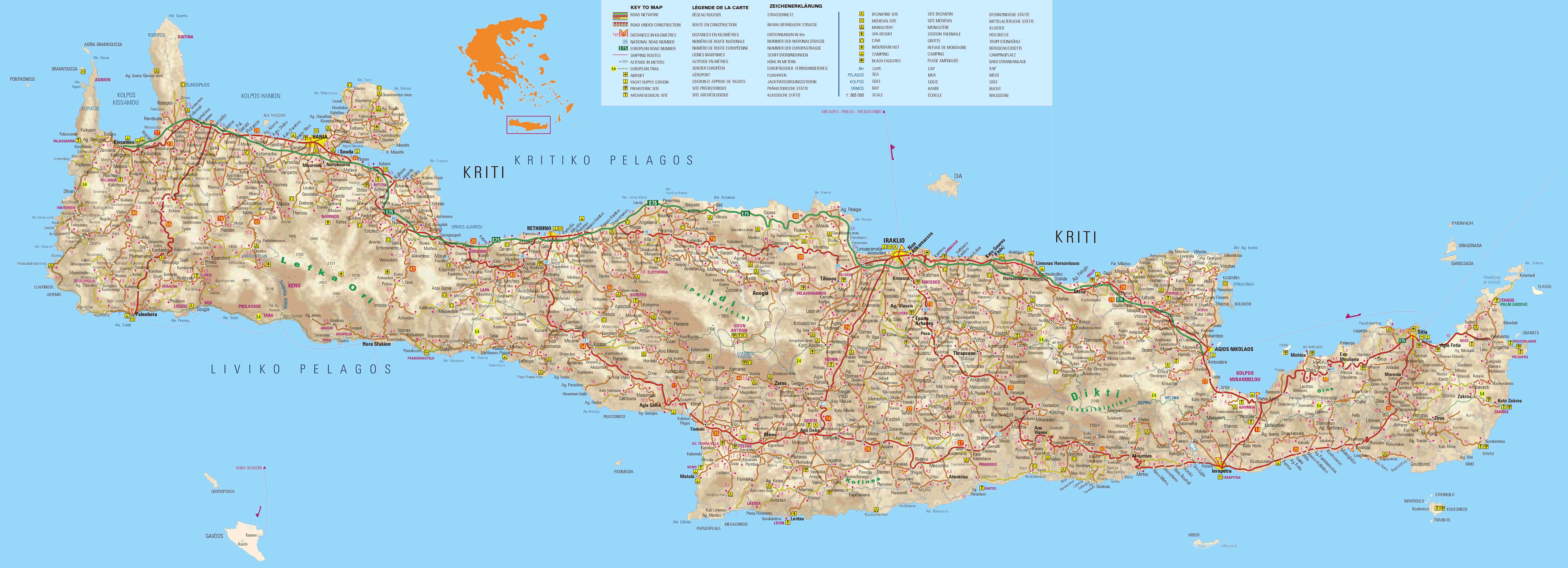
Maps of East and West Crete
click on the pictures to see the original larger files:
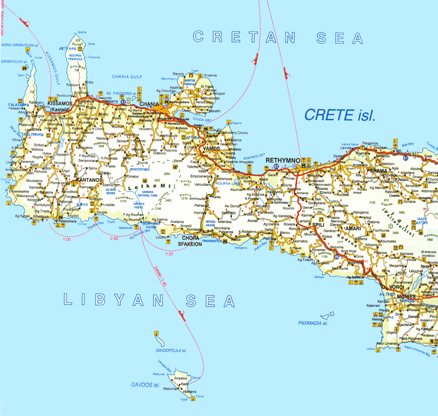
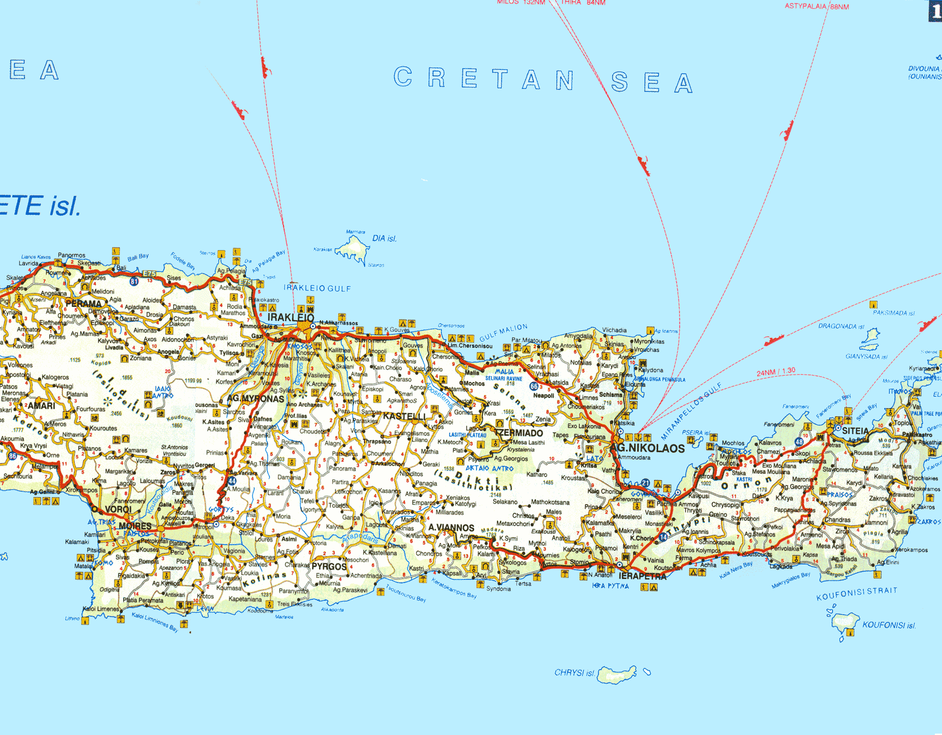
Large Map of Crete
This file is 3 MB and it is a very detailed map of Crete
Maps of the cities of Chania, Rethymnon, Heraklion and Agios Nikolaos
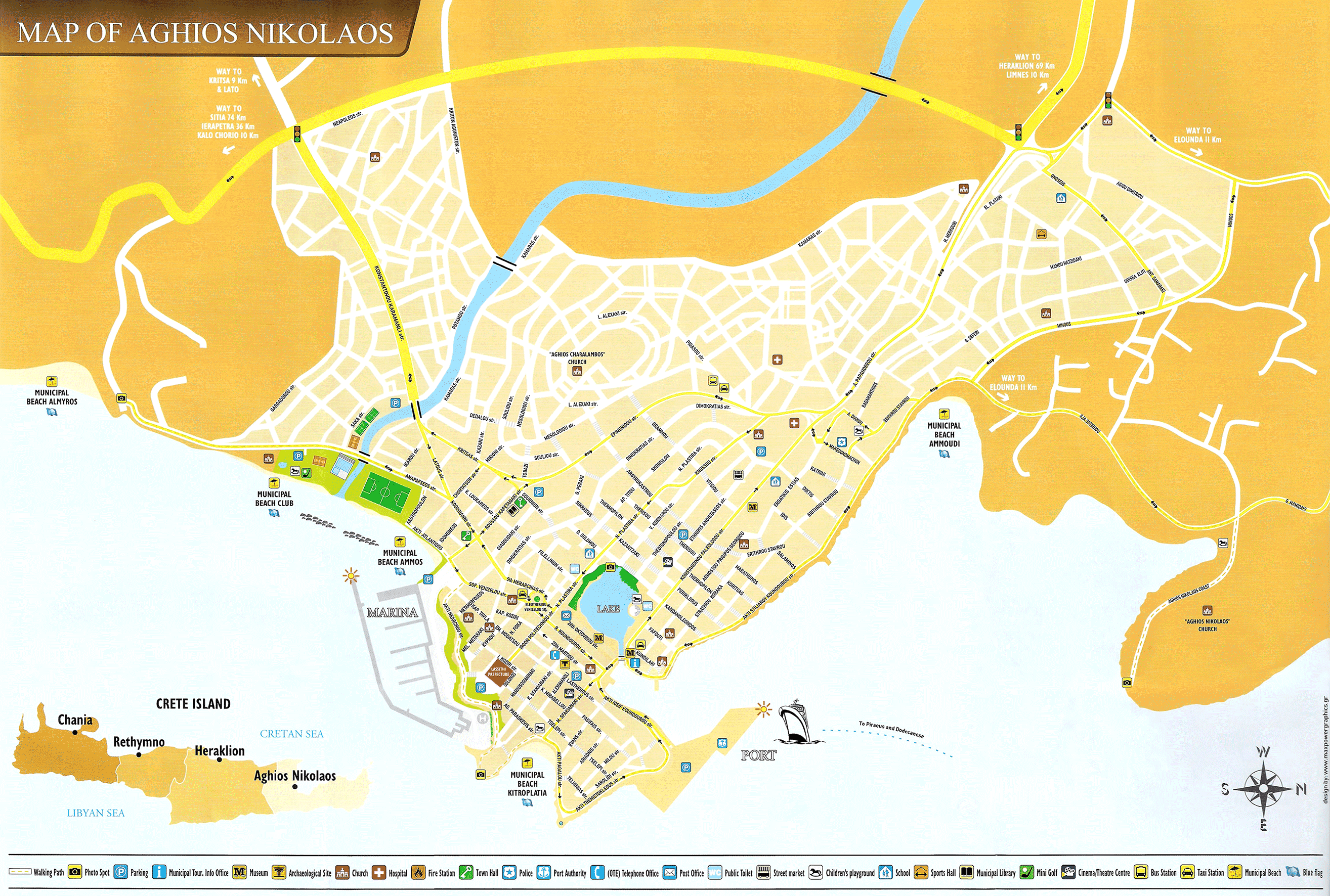
Agios Nikolaos map
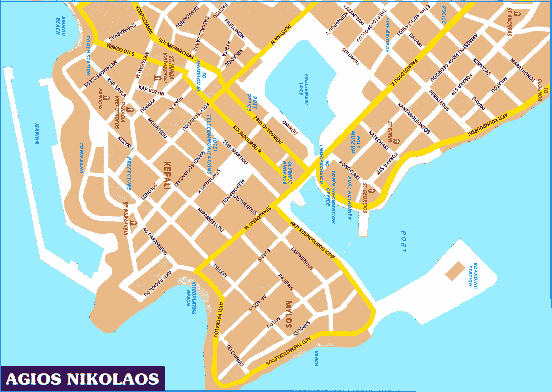
a new, more detailed map of Agios Nikolaos
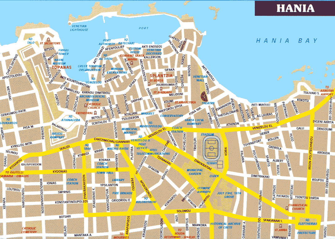
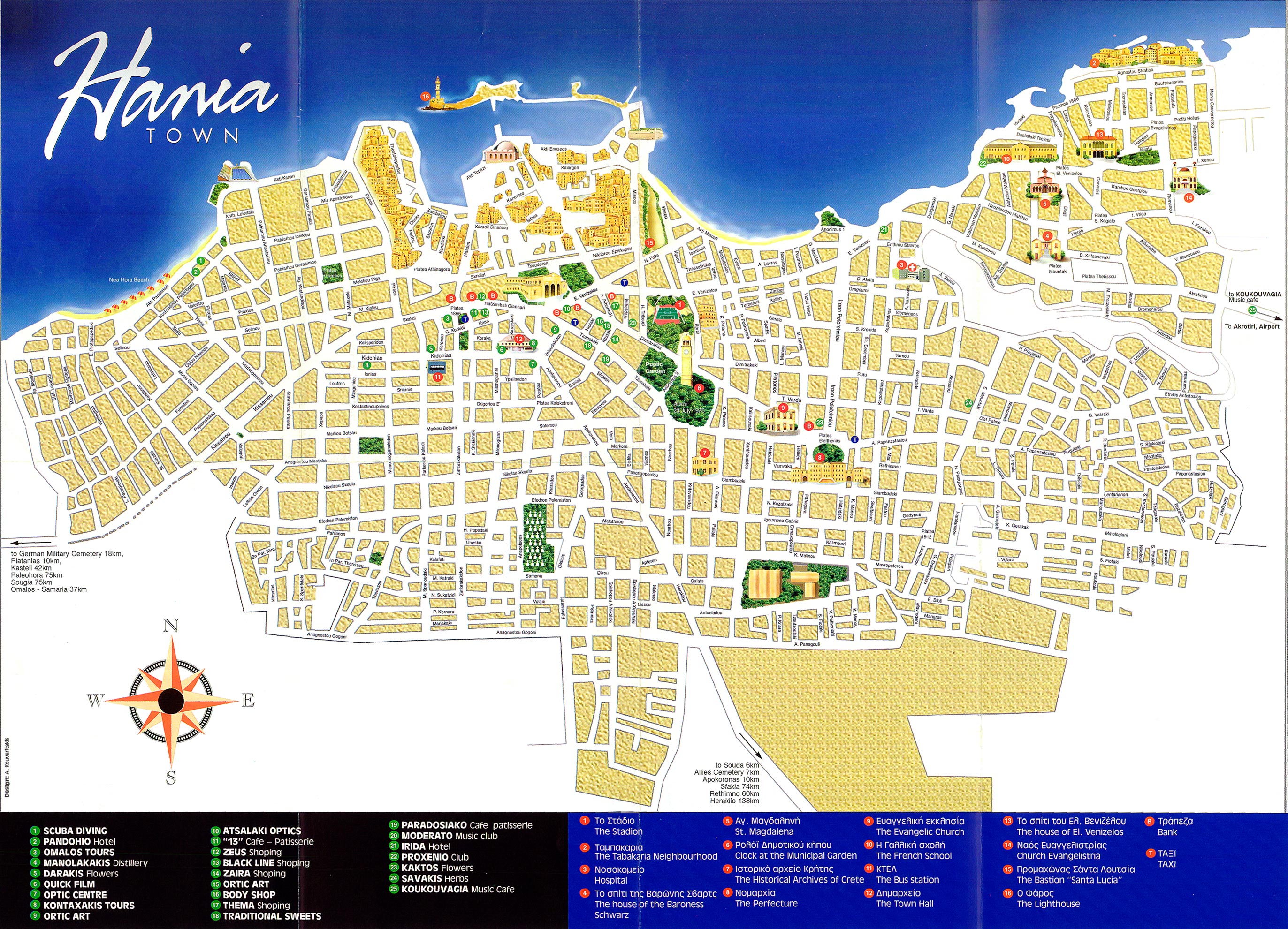
Chania map
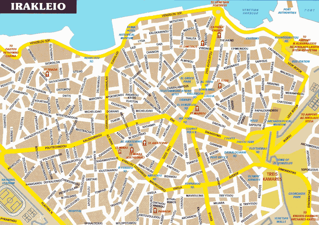
Heraklion map
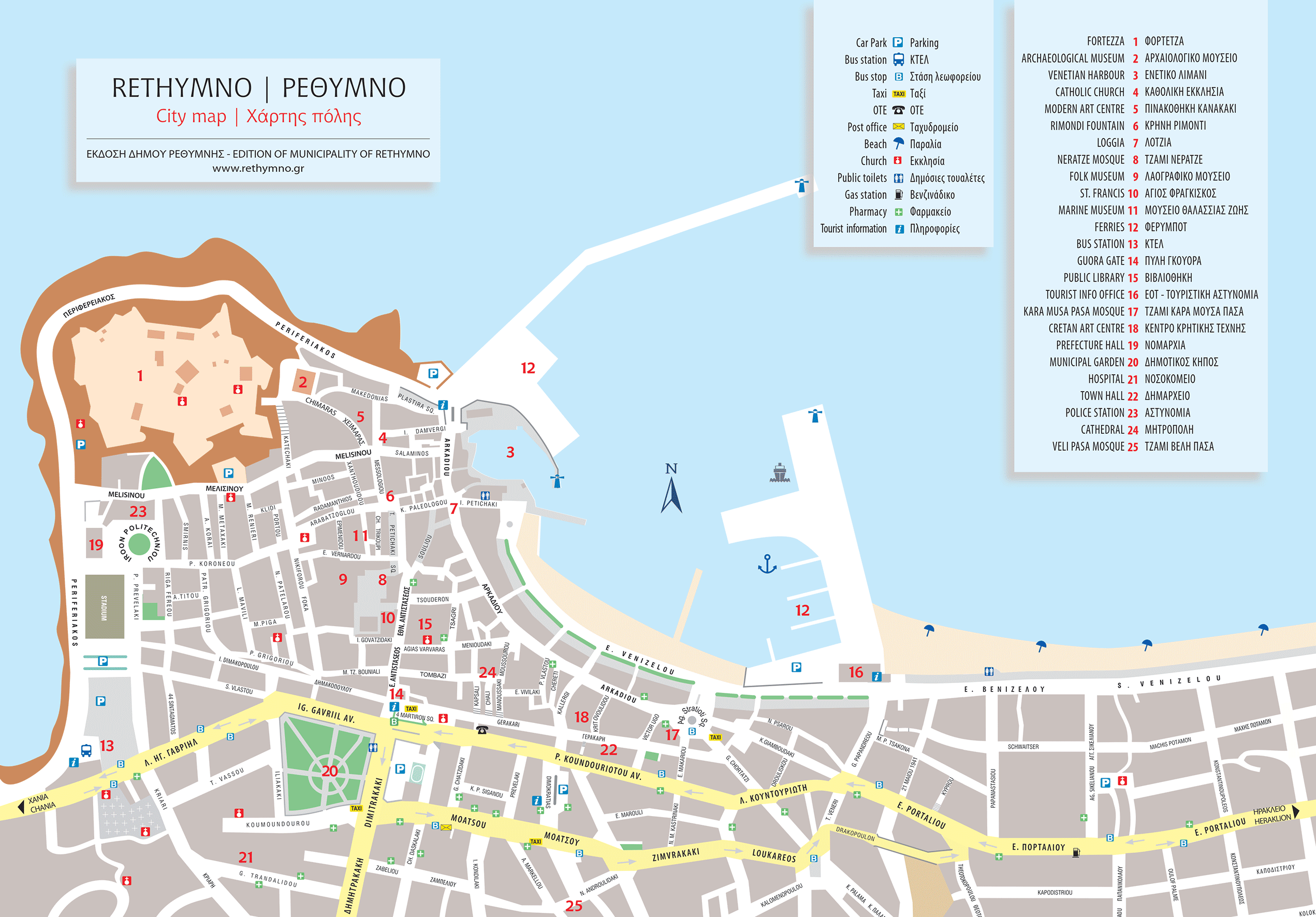
Rethymnon map
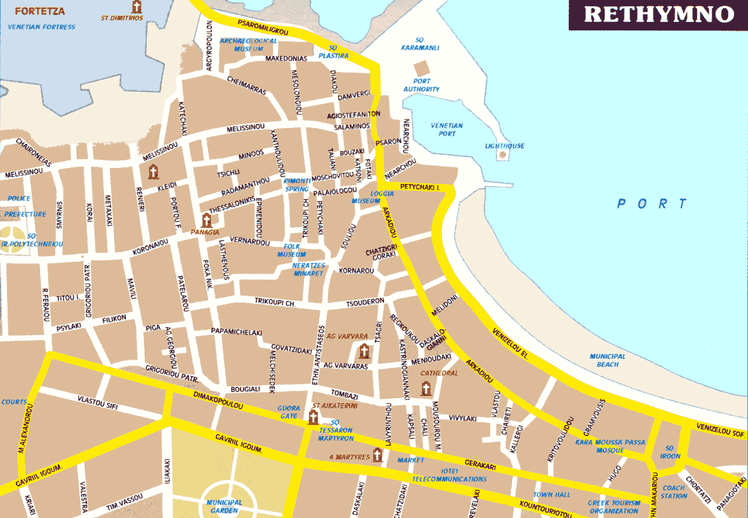
A new, better map of Rethymnon
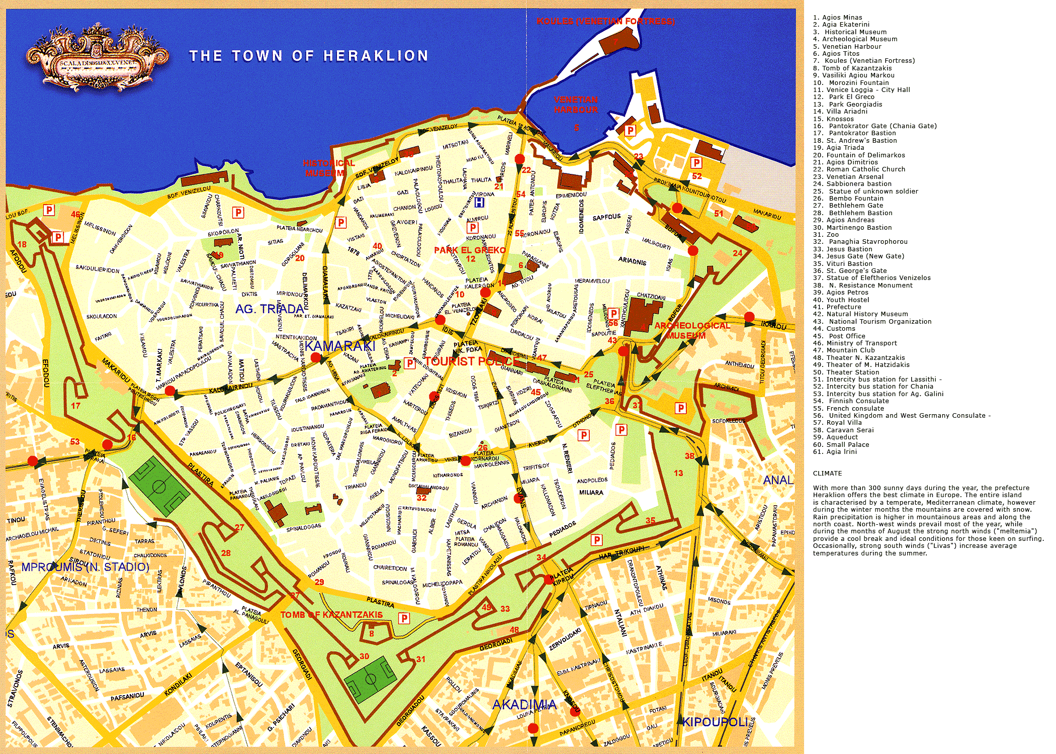
Map of the centre of Heraklion (800 KB) with all the places of interest marked on it
Map of the old town (Venetian) of Chania (1,60 MB) with all the places of interest marked on it
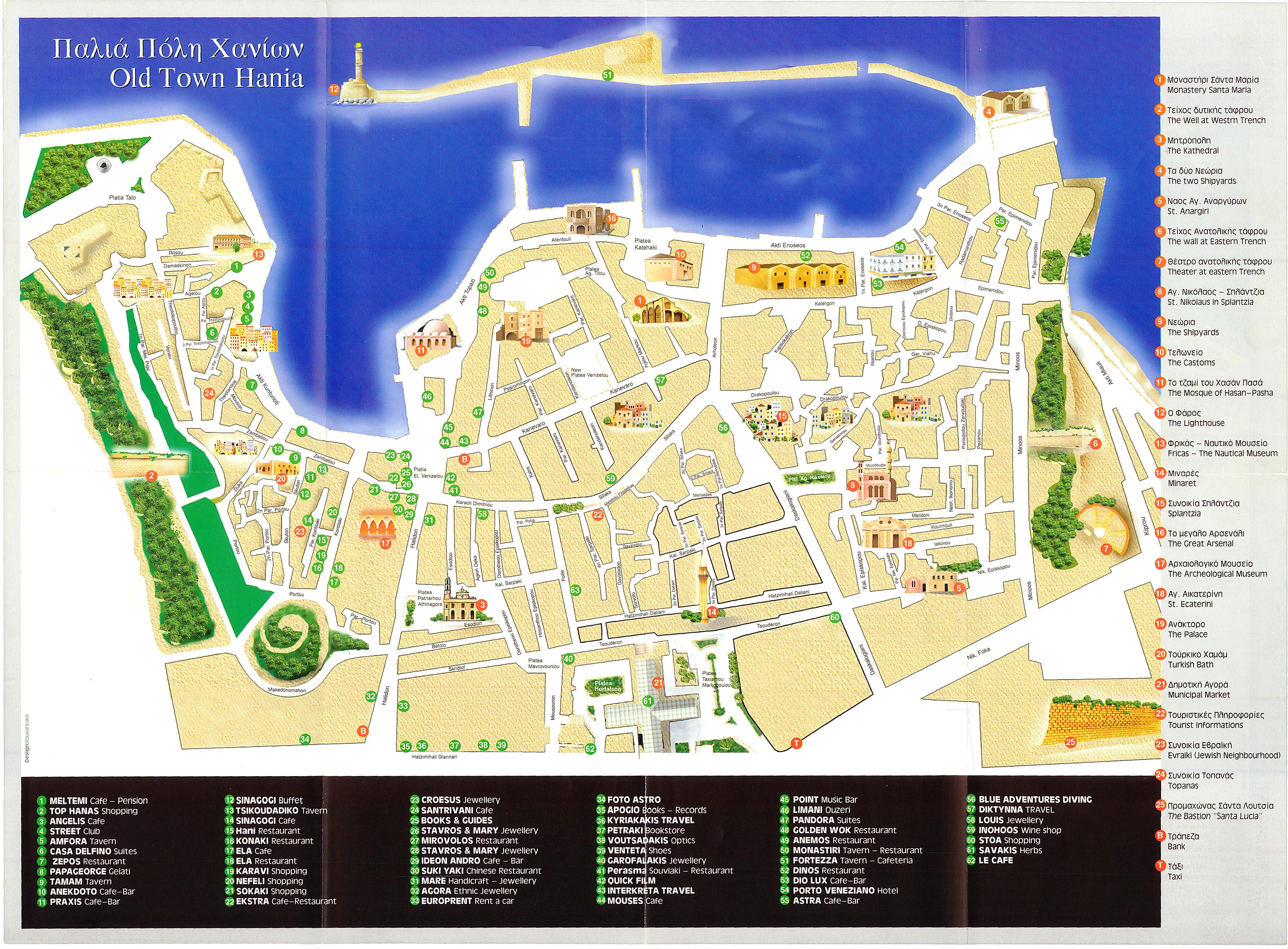
You can also check this page with links to the main sites in the city of Chania: Map of Old Town of Chania
Map of the city of Chania (1,3 MB)
It is a rather old one, but it will give you an idea of the whole of the city.
Paleochora:
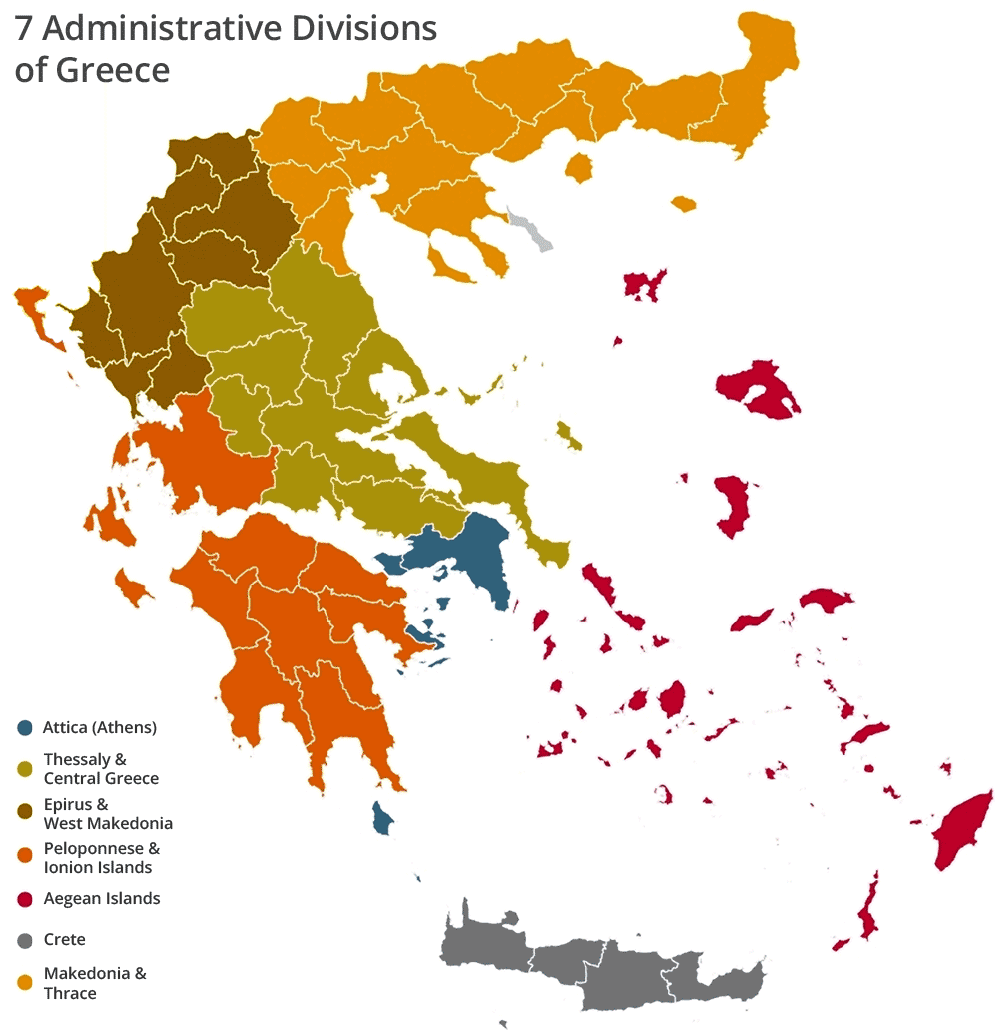
Map of Greece or Hellas
A simple map of Greece with the 7 administrative divisions
© explorecrete.com All Rights Reserved. Reproduction or copying without permission is prohibited.